Archaeological Surveys in Morocco for the Reconstruction of Punic Archaeometallurgical Sites in the Maghreb
Areas of Interest
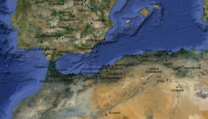
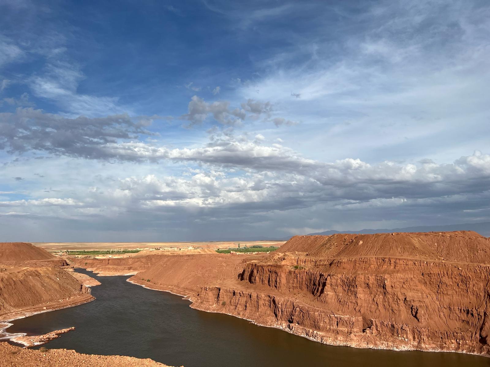
The ISPC CNR -MAECI research project conducted in Morocco since 2012 in the mining areas located in the northeast in the Middle Atlas, aims to reconstruct the phases and landscapes related to the production of metals, from extraction to artifacts, in the region marked by the Moulouya River. The Middle Atlas can be defined as a watershed between the Rif Mountains to the north, the western Atlantic zone, the Eastern Meseta, the Algerian highlands and the Saharan region to the south. The valley of the Moulouya results be the only route in Morocco connecting north to south which starts near Midelt and runs up to the Mediterranean Sea, while its tributaries reach the ocean to the south. In this sense, the river Moulouya seems to be the most direct and natural way of penetration from the Mediterranean Sea to Saharan regions.
the Zaida Mine ( long 6°07’53.37″ ; lat 32°24’39.53″: Focus on the connection of the Zaida mine with the protohistoric necropolis of Tayadirt with material from the Punic tradition
The poly-metallurgical district of Zaida, Midelt, Mibladen and Aouli, in the province of Midelt,
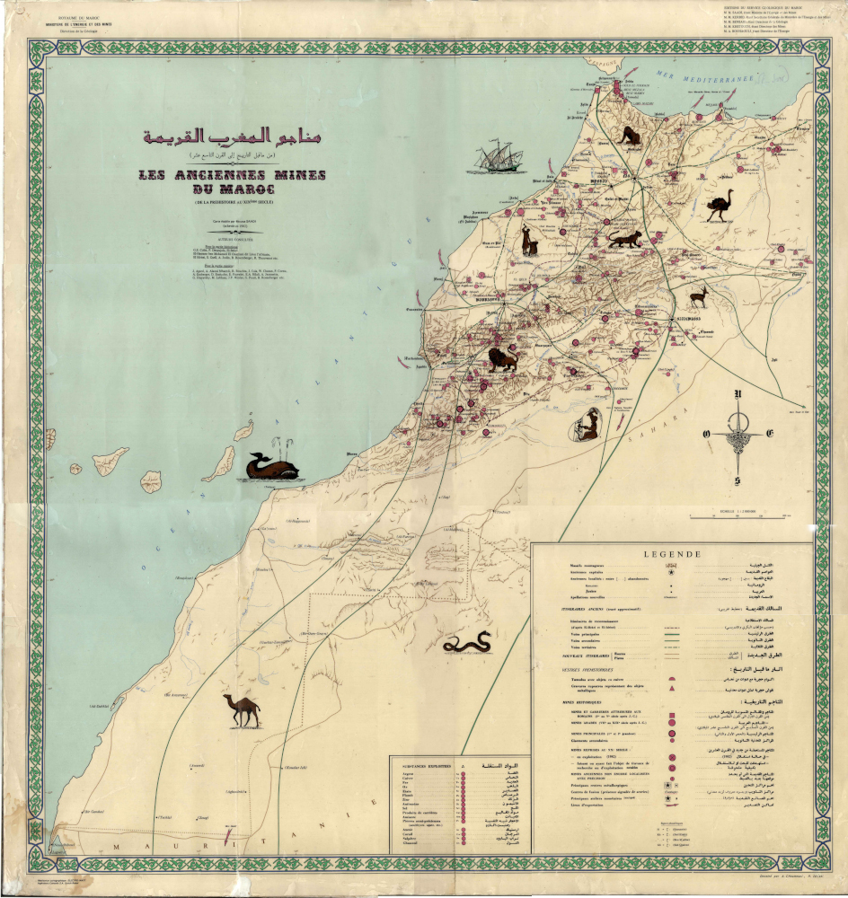
Map of old Moroccan mines from prehistory to the 19th century
is of great importance. In 2013, thanks to the bilateral agreement between the CNR and the University of Meknes, it was possible to carry out prospecting up to the silver-lead and copper mine of Zaida, very close to the necropolis of rich in objects reminiscent of Phoenician traditions.
In addition, the mines are evidence of a transformation of the environment. From this perspective, the analysis of the ancient landscape, in terms of viability, territorial darkness (fortresses, kasbahs and ksar) and mining activities (ancient and recent) has been pursued by means of tools deriving from historical sources, cartography, archaeological and topographical research, from the survey activity and the use of remote sensing techniques. The final result was the creation of a GIS system, for information management, that allows spatial and attribute queries, to monitor, manage, update and represent topographical and archaeological data.
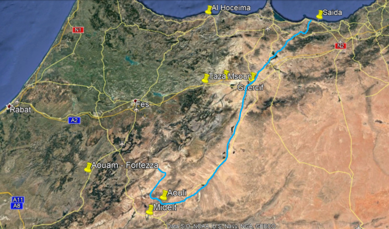
In eastern Morocco, the Moulouya, which flows 600km along the slopes of the Middle Atlas from Jebel Aberdouz in Arhbala to the Mediterranean, where it joins Ras El Ma in Saida, is the best, if not the only, route between south and north
